


Jan Komarek
Data uncertainty
Combining outdoor passion with academic curiosity to build and support a growing community in drone-based environmental remote sensing.
Behind the initiative
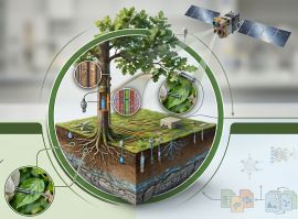
Drones and satellites are transforming how we observe our environment. They offer trans-scalar perspectives—from macroscopic global footprints down to sub-meter physiological processes that help us understand landscapes, ecosystems, and the changes unfolding across them. Yet to realise their full potential, what matters just as much as technology is the way we share knowledge and work together.
OpenSkyLab is a platform and community for open drone data and environmental remote sensing, bringing together researchers, practitioners, and students to share ideas, datasets, and methods across disciplines and borders. Our aim is to turn fragmented efforts into an open network that fosters reproducible science, practical applications, and long-term pre-symptomatic monitoring of our planet.
A key part of this effort is metadata. Every dataset becomes transparent and reusable only if we know how it was collected and processed. Whether mapping basic structural metrics or conducting complex functional inversions of physiological stress, we emphasise systematic records of flight parameters, sensor calibration, environmental conditions, and processing provenance. Aligned with FAIR principles and international geospatial standards, these auxiliary files allow multidimensional datasets to be integrated across projects, assimilated into advanced physics-informed models, and validated against in situ field data. Only then can information derived from drones be confidently reused.
Read more
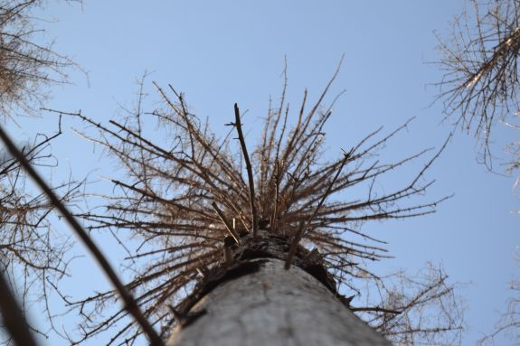
While satellite remote sensing has undergone significant standardisation, drone data still often fall short. Drones have emerged as a powerful technology, offering pixel sizes of a few millimetres that can successfully bridge the spatial gap between macroscopic satellite observations and tissue-scale plant physiology. However, the common proclamation that drones are a cheap, "anywhere-anytime" solution is often an illusion. Today’s environmental challenges require a paradigm shift. To understand how ecosystems respond to compound drought and heatwaves, we must move from reactive diagnostics to pre-symptomatic prediction. Our goal is to identify irreversible ecosystem tipping points, such as impending hydraulic failure and the loss of xylem conductivity—long before visual symptoms emerge.
Extracting this level of functional intelligence from the Soil-Plant-Atmosphere Continuum is highly demanding. It requires decoupling photochemical yield from canopy structure and thermodynamically partitioning evapotranspiration through rigorous, physics-based retrieval. This demands expensive hyperspectral and thermal instrumentation, precise sensor calibration, and extensive field campaigns. Until AI-driven analysis becomes seamlessly integrated, acquiring such data involves compensating field operators, covering sensor depreciation, and building interdisciplinary capacities. Because this level of scientific rigour represents a substantial investment, standardisation, open data sharing, and robust metadata are non-negotiable.
Whether you are a scientist aiming to redefine environmental monitoring, a stakeholder, or simply curious about the future of remote sensing, OpenSkyLab invites you to explore, contribute, and join a growing community dedicated to transparent, impactful, and reproducible science.
Recent updates and stories

Drones are grounded 75% of the year due to weather constraints
Read moreBackground activities
People behind the initiative

Data uncertainty
Combining outdoor passion with academic curiosity to build and support a growing community in drone-based environmental remote sensing.

Optical domain
Connecting academic expertise in Geoinformatics and Earth observation with practical solutions for environmental challenges.

Thermal domain
Passionate about nature and spending time outdoors, connecting personal enthusiasm with scientific exploration of the environment.

Atmospheric domain
Fascinated by forests and the stories hidden in wood – from living trees to aged timber – and connecting them through curiosity and observation.